
Earth Curvature Calculator
Calculate the hidden curve of the Earth instantly with a clean and responsive tool.
What is Earth Curvature Calculator?
An Earth Curvature Calculator is a useful online tool that helps calculate how much the Earth curves over a certain distance. Since the Earth is round, its surface naturally bends downward as distance increases. This calculator estimates the amount of curvature between two points and shows how much of an object may be hidden below the horizon due to the Earth’s shape.
The Earth Curvature Calculator is commonly used by surveyors, engineers, photographers, pilots, boat navigators, and science enthusiasts who want to understand line-of-sight visibility over long distances. It uses mathematical formulas based on the Earth’s radius to provide accurate curvature results in meters, feet, or other units.
Whether you are checking visibility across a lake, calculating observation distances, or simply exploring how Earth’s geometry works, this tool provides quick and reliable calculations in seconds. The calculator is beginner-friendly and works smoothly on desktop, mobile, and tablet devices.
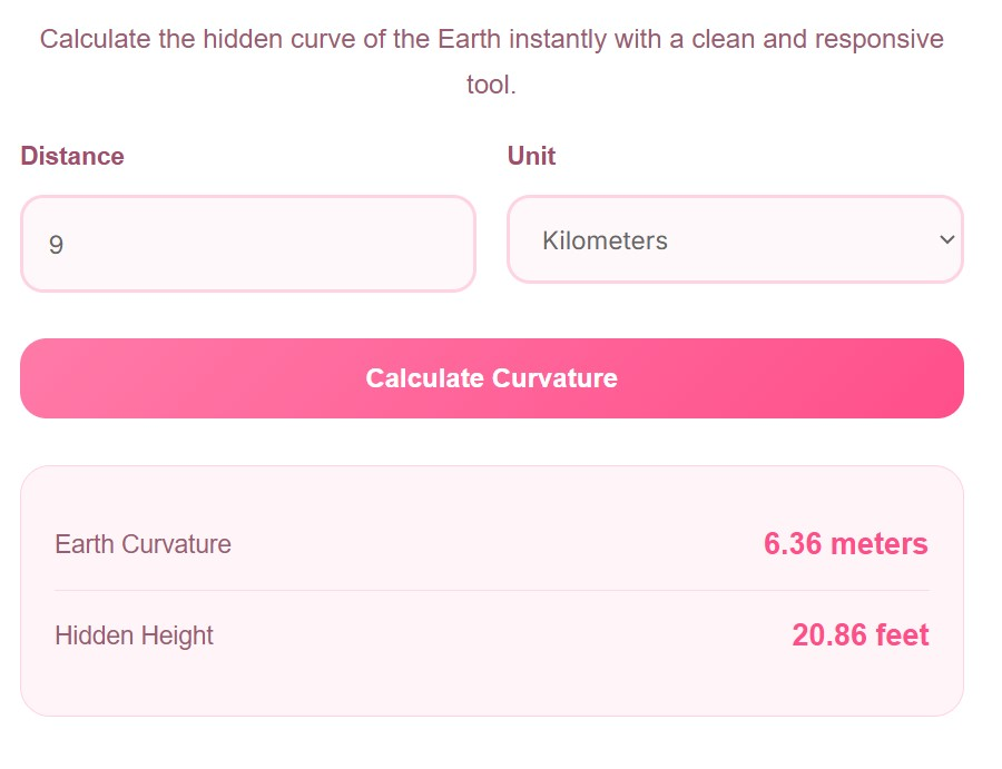
How to Use It
Using the Earth Curvature Calculator is very simple and does not require any technical knowledge. Follow these easy steps to calculate Earth curvature instantly:
First, enter the distance between two points in the input field. You can enter the value in kilometers or miles depending on your preference. After that, select the measurement unit from the dropdown menu.
Once the values are entered, click the “Calculate Curvature” button. The calculator will instantly process the information and display the estimated Earth curvature and hidden height caused by the curve of the Earth.
You can repeat the process with different distances to compare results and better understand how curvature changes over longer ranges. The tool is designed to deliver fast and accurate outputs without complicated formulas or manual calculations.
Advantages of Earth Curvature Calculator
The Earth Curvature Calculator offers several advantages for both educational and practical purposes. One of the biggest benefits is accuracy. Instead of solving complex geometry equations manually, the calculator provides instant and precise results automatically.
Another major advantage is time-saving. Users can calculate Earth curvature within seconds without needing scientific calculators or advanced mathematical skills. This makes the tool ideal for students, researchers, travelers, and professionals.
The calculator also improves understanding of Earth’s geometry and visibility over long distances. It helps explain why distant objects appear lower on the horizon and why certain landmarks become hidden from view.
Its responsive and mobile-friendly design allows users to access the calculator on any device including smartphones, tablets, and desktop computers. This flexibility makes it convenient for users working in the field or studying remotely.
Additionally, the calculator supports multiple units such as kilometers and miles, making it useful for users worldwide. The simple interface ensures a smooth user experience even for beginners who are using such tools for the first time.
Why Earth Curvature Matters
Earth curvature plays an important role in many real-world applications. In construction and engineering projects such as bridges, railways, and canals, understanding Earth curvature helps ensure proper alignment and structural accuracy over long distances.
In photography and videography, curvature affects visibility and horizon appearance. Landscape photographers often use curvature calculations to determine how much of a distant object will remain visible from a specific location.
Aviation and marine navigation also depend on curvature calculations for accurate line-of-sight communication and route planning. Pilots and sailors must account for Earth’s curve when calculating visibility between locations.
Even in telecommunications, Earth curvature influences signal transmission for radio towers and satellite communication systems. Engineers use curvature data to optimize antenna placement and improve connectivity.
Because of these practical uses, an Earth Curvature Calculator becomes a valuable tool for many industries and educational purposes.
Earth Curvature Formula
The calculator uses a standard mathematical formula based on the Earth’s average radius. The commonly used equation is:
Curvature = Distance² ÷ (2 × Earth Radius)
In this formula, the Earth’s radius is approximately 6,371 kilometers. As distance increases, the curvature value grows significantly. The calculator automatically handles these calculations and converts results into readable units for users.
FAQs
Is the Earth Curvature Calculator accurate?
Yes, the calculator uses scientifically accepted formulas based on the Earth’s radius to provide accurate curvature estimates for most practical applications.
Who can use this calculator?
Students, engineers, surveyors, photographers, pilots, navigators, and anyone interested in Earth science can use this tool easily.
Can I calculate curvature in miles?
Yes, the calculator supports both kilometers and miles so users can choose their preferred unit.
Why do distant objects disappear below the horizon?
Because the Earth curves downward over long distances, lower parts of distant objects gradually become hidden behind the horizon.
Does weather affect Earth curvature calculations?
Weather does not change the Earth’s curvature itself, but atmospheric refraction can slightly affect visibility over long distances.
Is this calculator mobile-friendly?
Yes, the calculator is fully responsive and works smoothly on smartphones, tablets, laptops, and desktop devices.
Disclaimer
This Earth Curvature Calculator is intended for educational and general informational purposes only. Results are approximate and may vary depending on atmospheric conditions, elevation, and measurement accuracy.
Always consult professional engineering or surveying resources for critical scientific, construction, or navigation-related calculations.